![]()
1904 NYNH&H RailroadBoston Freight Terminal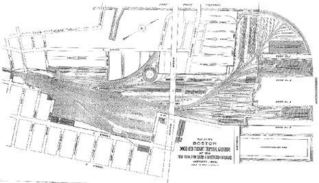
This blackline copy of the track map of the Boston Freight Terminal of the New York, New Haven & Hartford Railroad covers the area between Fort Point Channel (to the west), D Street and Commonwealth Pier (to the east), the pier warehouses (to the north), and West Second Street (to the south). I am currently restoring this map digitally. The cleanup of the background is substantially complete at this time |
Full-Scale36"x57" Blackline laser-print on 20-pound bond paperFull-scale (1"=100') - our price: 19.75 New Haven Railroad in Boston Half-Scale17-1/2"x30" Blackline laser-print on 20-pound bond paperHalf-scale (1"=200') - our price: $9.75 New Haven Railroad in Boston |
1914 Brooklyn-Manhattan Transit Corp. (BMT) Map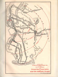
|
This reprint of the 1914 map depicts the proposed expansion of the BMT subway system. This color reprint measures 8"x10-1/2" and is printed on bright white bond stock. This is a new reprint, not an inkjet reprint. 8"x10-1/2" Color reprintOur price: $3.75 New York Mass Transit |
|
| |